Historic Aerial Imagery
Visualise Victoria’s land history with historic aerial imagery
Access decades of change. Instantly.

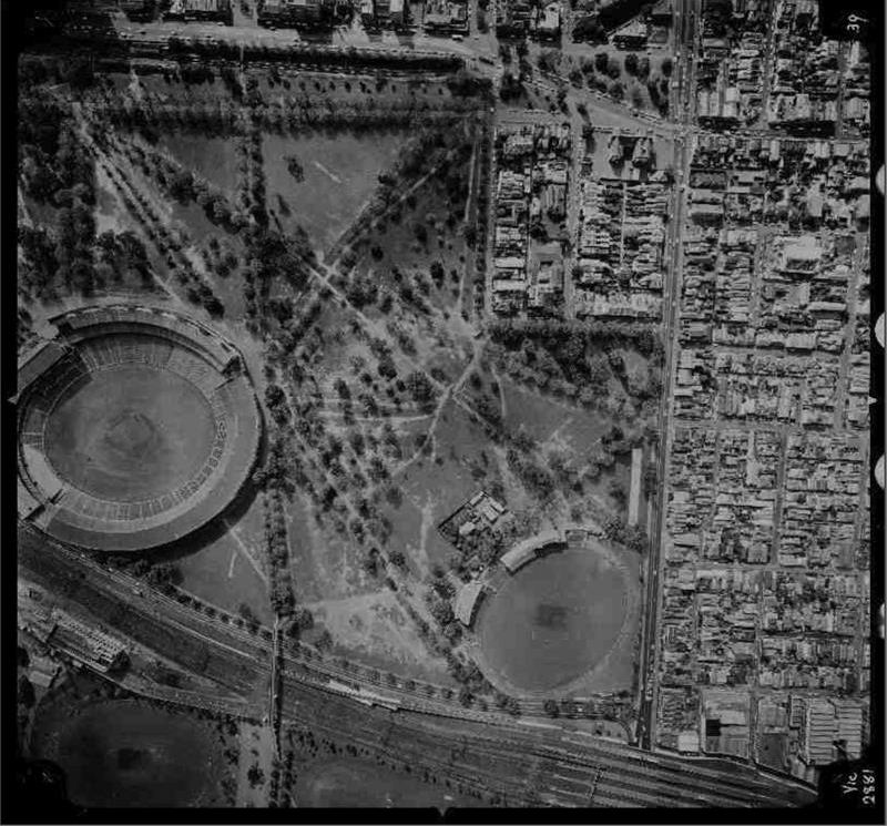
Historic Aerial Image of the MCG circa 1974
Make confident decisions with clear visual history
Whether you're identifying environmental change, confirming development timelines, or tracing historic land use, you need consistent imagery you can trust.
With Historic Aerial Imagery, you get:
- Coverage from the 1930s to 1990s
- Image metadata including date, location, scale, and camera specifications
- GIS-ready files for spatial analysis
- Bulk delivery in PDF and CSV formats
- Exclusive access to LANDATA’s curated archive
- BY-NC 4.0 license for compliant reuse
Everything in one place. Ready to go.
Access imagery from the 1930s to 1990s complete with scale, coordinates and capture details.
Uncover what’s changed and why it matters
SERV’s Historic Aerial Imagery gives you medium and high-resolution aerial photographs of Victoria dating back to the 1930s.
Sourced exclusively from LANDATA, each image is metadata-rich and GIS-ready so you can:
- Track historical land use
- Measure environmental or infrastructure risk
- Make confident decisions with visual, verifiable evidence
Delivered in bulk and licensed under Creative Commons BY-NC 4.0, this is the fastest way to bring decades of land history into your workflow.

Historic Aerial Image of Collins Street, Melbourne circa 1945
Historic data, modern impact
Getting reliable historic imagery is usually a slow, manual task.
You chase down custodians, scan old photos, or stitch together low-res images, often with missing metadata.
That means delays. Gaps in context. And unanswered questions.
Missing historical data can stall approvals, slow assessments, and add unnecessary risk to your project.
Real users. Real value.
Government & Planning Teams
Validate permits, trace development, assess land use change.
Environment & Risk Assessors
Map environmental change, identify flood risk, build climate resilience.
Heritage & Culture Specialists
Reveal historic structures, landscapes, and settlement patterns.
Insurers & Lenders
Understand land condition and usage for underwriting and risk assessment.
Researchers & Universities
Model urban growth, track biodiversity loss, support evidence-based policy.
Developers & Infrastructure Specialists
Verify site history, reduce planning risk, support brownfield redevelopment.